Understanding the landscape of Samaná Bay
Los Haitises: Mangroves, Birds and Cave Art
Look beyond the boat route to understand Los Haitises: its limestone landscape, mangrove habitat, birdlife and Indigenous rock art. Discover what to notice and how to explore without disturbing the place.
What makes Los Haitises different?
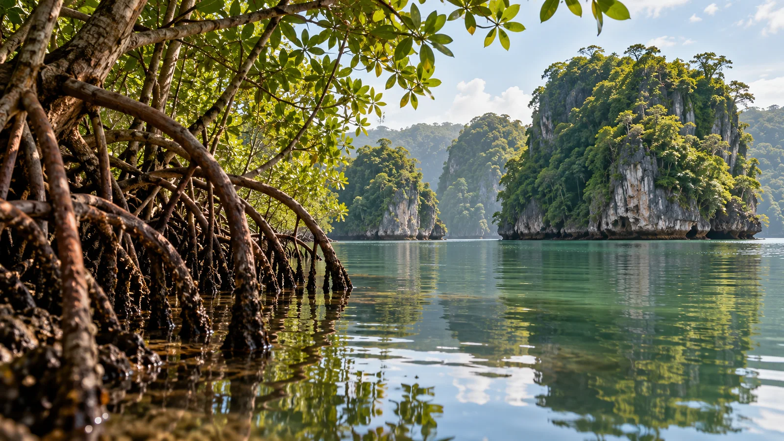
Los Haitises brings several kinds of landscape together: forest-covered limestone formations, coastal water, mangrove fringes and caves with Indigenous rock art. The value of a visit is in noticing how these features connect, rather than treating every stop as another photograph. A boat can change your view of a rocky cay or a forest edge in moments, while an explanation from the guide helps make sense of what you are seeing.
The park lies around the southern side of Samaná Bay, not beside the peninsula’s north-coast hotel beaches. Your departure point determines the journey to it. Use the Los Haitises visitor guide for harbours, boarding and access questions. This article explains the place itself so you can arrive with more than a list of stops to complete.
Read the limestone landscape
Karst is a landscape shaped by the dissolution of soluble rock, including limestone. Water acts through cracks and openings over long periods, helping form distinctive surface shapes and underground spaces. In Los Haitises, the forested limestone relief and caves are parts of the same broader geological setting. You do not need a specialist vocabulary to begin recognising the relationship between rock, vegetation and water.
Look at the outlines of the formations, the vegetation above them and the changes in perspective as the boat moves. Ask the guide which features are visible along your particular route. A general explanation of karst does not establish the precise age of a cave or every stage of its formation, and an unusual rock shape should not become an invented geological story simply because it resembles an animal or a building.
Mangroves are a living habitat
Mangroves are trees and shrubs adapted to coastal environments influenced by salt water and tides. Their roots can create intricate structures at the water’s edge, providing shelter for fish and other organisms. These coastal forests also help stabilise shorelines and slow water movement. What appears from a distance to be a solid green margin contains a complex meeting place between land and water.
Observe the roots, reflections and transitions between open water and vegetation from the permitted route. You may not see the smaller animals using the habitat, and the absence of a visible fish does not mean the roots are empty. Avoid reaching into the vegetation, breaking branches or asking to leave the vessel at an unapproved point. The mangroves are part of the experience to understand, rather than scenery to rearrange for a photograph.
Watch birds through their relationship with the place
Birdlife is one reason to look beyond the rock formations. Pelicans, herons and egrets are among the birds associated with the park’s coastal landscape. Watch where a bird is feeding, resting or moving rather than concentrating only on adding a name to a list. Different habitats and moments reveal different activity, and the guide can help distinguish an identification from a distant shape that remains uncertain.
A general park excursion is not automatically a specialist birdwatching trip. If birds are your main interest, ask about the guide’s knowledge, the proposed observation areas and how much time the group can spend looking. Binoculars may help if you have them, but do not assume equipment is supplied. Avoid requests to approach nests or provoke flight for a photograph, and never treat a species mentioned in a description as a guaranteed sighting.
Cave art: painted images and carved markings
Los Haitises contains caves with pictographs and petroglyphs, forms of rock art connected with the island’s Indigenous heritage. A pictograph is a painted image; a petroglyph is made by carving or working the rock surface. Those terms describe how a mark was made, not a complete explanation of its meaning. Understanding the distinction gives you a useful starting point when a guide points out a particular example.
Keep the artwork separate from the natural marks and shapes of the cave. Ask which features are identified as rock art and what supports the interpretation. The park’s cultural importance does not mean every cave contains the same images or is open to visitors. A named cave becomes part of your excursion only when the proposed route and current permission allow that visit.
Appreciate the heritage without inventing its meaning
Indigenous rock art is more than decoration for a cave photograph. It is evidence of people’s relationship with the landscape, and it deserves careful interpretation. Ask the guide to distinguish an established observation, an archaeological interpretation and an uncertain possibility. A shape that looks familiar to a modern visitor does not by itself establish the original subject, purpose or message.
Avoid repeating a precise age or a confident symbolic meaning unless there is a sound basis for it. The same care applies to attributing every mark to a particular group or treating all Indigenous history as one undifferentiated story. You can appreciate the significance of a cultural place while recognising that some questions remain open. Curiosity is more useful here than a memorable explanation presented as certainty.
Explore without leaving a mark
Leave rock art and cave surfaces untouched. Do not trace images, make rubbings, add marks or remove objects. Follow the guide’s directions about movement, lighting and photography at the specific stop, rather than assuming the arrangements in another cave apply here. Wet surfaces, low light and changes in level also deserve attention while looking at the surroundings.
On the water, respect the crew’s decisions about routes, wildlife and landings. Keep rubbish with you, leave roots and vegetation undisturbed and allow animals space. A closer view is not automatically a better visit if obtaining it disturbs the place. The park’s natural and cultural features are connected by the same principle: observe what is there without changing it for the next person.
Choose interpretation as well as transport
A useful guide helps you notice features you might otherwise pass: the shape of a limestone formation, the roots at the waterline, the behaviour of a bird or the difference between a natural mark and rock art. Ask which language the interpretation is offered in and whether the proposed experience leaves time to listen and ask questions. Reaching a stop and understanding it are different parts of the visit.
The Los Haitises National Park tour page is the relevant enquiry route. Request the departure harbour, vessel, named permitted stops, guide arrangements and complete return journey. Ask how conditions or access instructions can change the route. A general park description should not be read as a promise that every cave, mangrove passage or bird-observation area is included.
Is this the nature experience you want?
Choose Los Haitises when landscape, natural history and cultural interpretation are central to the day you want. It offers a different kind of interest from spending most of an outing beside a waterfall or on a beach. Your comfort with the vessel and any permitted landings still matters, even when learning about the park is the main reason for going.
If you are choosing one nature excursion, the El Limón or Los Haitises comparison weighs the trail-and-waterfall experience against a park outing by boat. Neither name establishes the same level of effort for every group. Choose the place that interests you, then assess the actual route rather than assuming that a seated boat journey removes all walking or boarding requirements.
Give the park room in your Samaná stay
A day with space for the journey, interpretation and return can be more satisfying than an itinerary built around the largest number of names. Decide whether the park is your priority or one part of a wider proposed outing. If another destination is added, compare how much time remains for Los Haitises itself. An extra stop should reflect your interests, not simply make the description look fuller.
The three-day Samaná itinerary helps separate inland, bay and coastal plans. Your accommodation and actual harbour influence how the park fits. Keep exact timings, cave permissions, admission, meals and any island extension for confirmation in the proposal; understanding the landscape does not establish the services or access available on a particular date.
Is Los Haitises mainly a beach trip?
Its main appeal is the protected landscape, habitats and cultural heritage. Do not choose a park excursion on an assumption of extended swimming or a beach lunch. If those are important to your group, ask whether they form a separately described part of the route and compare the time they leave for the park.
Will every tour visit the same caves and see the same birds?
No. Proposed stops, permissions, departure points and conditions can differ, while wildlife remains free-ranging. Ask which caves or observation areas are planned and how changes are handled. Neither the park name nor an illustration establishes the route or sightings for your particular departure.
Can families enjoy the interpretation?
Children may enjoy looking for roots, recognising rock shapes and asking what a bird is doing. Keep explanations suited to their interest and attention, without promising wildlife. Assess the boat, suitable life jackets, shade, boarding and cave approach separately. Educational value does not establish that every route suits every child.
Explore Los Haitises with more to notice.
Compare the park experience, share your starting point and interests, and confirm the guide, permitted route and complete arrangements before booking.
Explore Samaná experiences